By: Mathieu Morlighem, Department of Earth Sciences, Dartmouth College and Shfaqat Abbas Khan, DTU Space, Technical University of Denmark, Denmark
Greenland is home to the planet's largest ice sheet outside of Antarctica. Observations collected from the ground, air, and space have revealed rapid thinning in the northeast part of this ice sheet that could contribute more to sea level rise than previously thought.
[video: width:700]
Animation 1. The Northeast Greenland Ice Stream, draining ice from a basin that spans about 12% of the Greenland ice sheet, flows through two main outlet glaciers that discharge into the North Atlantic Ocean. Video courtesy of Nicolaj Krog Larsen, Globe Institute, Denmark.
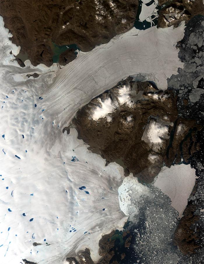
"Rivers" of relatively fast-moving ice, known as ice streams, flow from Greenland's interior toward its coasts. The Northeast Greenland Ice Stream is the island's largest, draining ice from a basin that spans about twelve percent of the ice sheet. Much of that land-based ice eventually flows through two main outlet glaciers, where it discharges icebergs and melts into the North Atlantic Ocean.
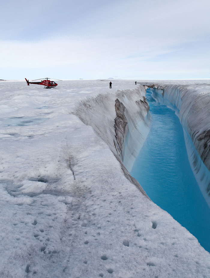
Over the past twenty years, the terminus of Zachariae Glacier has retreated by almost 30 kilometers and the Zachariae glacier lost its floating extension in response to the intrusion of warm ocean waters. We have been observing significant ice thinning and flow acceleration after this retreat, but it was not clear how far upstream the retreat of the terminus would affect the ice sheet. Satellite measurements included too much noise to be useful in detecting a potential wave of thinning or acceleration further inland. A team of scientists from the Technical University of Denmark went into the field and installed several GPS stations on the ice surface, which provide very accurate and high precision measurements of the horizontal and vertical movement of the ice sheet. To our surprise, we found that the ice was thinning up to 200 km inland, deep in the interior of the ice sheet, and this thinning was a direct consequence of the retreat of the glacier along the coast.

That was just the beginning of this story. This response of the Northeast Greenland Ice Stream was not predicted by numerical models and so the next natural step was to try to understand why the ice sheet was more sensitive to perturbations happening at its periphery than what we expected based on numerical simulations. One of the important factors that control the speed of ice flow is how fast it slides on the bedrock. It is extremely difficult to observe what is happening under hundreds-to-thousands of meters of solid ice, so we rely on laboratory experiments to derive simple relationships between basal drag and ice speed, called "friction laws." Several friction laws have been proposed over the years and it remains unclear which one applies to the sector we study. We developed a high-resolution state-of-the-art numerical model of the Northeast Greenland Ice Stream and ran the model over the past 15 years with different friction laws. We found that most laws led to ice acceleration and thinning close to the terminus, but the ice further upstream remained unaffected by the collapse of the floating extension of the glacier near the coast. We were running out of ideas. In a moment of insight, we decided to try another type of friction law, which is referred to as a "plastic law." The idea of this friction law is that there is a maximum amount of stress, or drag, that the bedrock can exert on the ice sliding on top of it, and this maximum stress cannot be exceeded. We changed the numerical model and implemented this new type of friction law and the model was literally spot-on. The model showed ice thinning and acceleration that was very close to what was measured by GPS stations in the field. This really felt like one of the few "Eureka" moments scientists experience in their career.
The final step of this study was to revise future projections of mass loss of this sector based on the knowledge that a plastic friction law applies to this sector. That was our third surprise: the mass loss was doubled compared to models that rely on more traditional friction laws that don't have a plastic limit. Because the plastic law leads to more thinning and acceleration of the ice stream, we were expecting the model to lose more mass, consistent with observations, but a factor of two is very significant.
Animation 2. This animation simulates the cumulative thinning of the Northeast Greenland Ice Stream since 2007 and projected through 2100. It is based on a model that provided the best match with observations of ice elevation collected from 2007 to 2021. Animation courtesy of Shfaqat Abbas Khan.
The observations for the model that Animation 2 is based on came from NASA's Operation IceBridge airborne mission, NASA's Ice, Cloud, and land Elevation Satellite-2 (ICESat-2), and the European Space Agency's (ESA) CryoSat-2 satellite.
Overall, this study was particularly interesting and insightful because it combined field measurements, satellite observations, and numerical modeling to discover that the ice sheet was much more sensitive to the intrusion of warm water along the coast than what we thought, and this information helped identify how the ice slides on the bedrock. This new knowledge led to a revised assessment of the future mass loss of this sector, which happens to be six times higher than previous estimates.
Further information is available on the Ice Future—Research Group website.
About the Authors
 Glaciologist Mathieu Morlighem joined Dartmouth College as the inaugural Evans Family Distinguished Professor of Earth Sciences in the Arctic Engineering in a Period of Climate Change cluster. His research interests are focused on better understanding the processes controlling the mass balance of Greenland and Antarctica, as well as reducing uncertainty in the projections of sea level rise using numerical modeling. He is one of the founders and core-developers of the Ice-sheet and Sea-level System Model, a new generation, multi-purpose, massively parallelized finite element framework.
 Shfaqat Abbas Khan is a Professor in Geodesy at the National Space Institute, Technical University of Denmark. Geodesy is a branch of applied mathematics and earth sciences that deals with measuring the size and shape of the Earth. His research interests include Research interest: GPS and crustal motion geodesy, plate tectonics, elastic loading of the Earth's surface, postglacial rebound, sea level change, GPS meteorology, realization of space geodetic reference frames, numerical modeling of geodynamic processes, Greenland ice mass loss, ocean tide and atmosphere loading, and glacier dynamics.

