A data-sharing agreement signed in August 2011 between the National Oceanic and Atmospheric Administration (NOAA) and three oil companies (Shell, ConocoPhillips, and Statoil) has laid the groundwork for the Alaska Ocean Observing System (AOOS) to provide public access to a wealth of oceanographic and environmental data collected between 2008 and 2012 in the Chukchi Sea.
By: Molly McCammon, Excutive Director, Alaska Ocean Observing System
A data-sharing agreement signed in August 2011 between the National Oceanic and Atmospheric Administration (NOAA) and three oil companies (Shell, ConocoPhillips, and Statoil) has laid the groundwork for the Alaska Ocean Observing System (AOOS) to provide public access to a wealth of oceanographic and environmental data collected between 2008 and 2012 in the Chukchi Sea.
Industry builds external stakeholders' confidence in their research by making data transparent, according to Caryn Rea, Alaska environmental studies lead for ConocoPhillips. She calls the agreement "transformative, from the perspective of the oil and gas industry. This is the first ever agreement that I'm aware of where a private company has been supportive of ensuring full public use of the private investment in oceanographic and environmental studies that support our industry. ConocoPhillips widely shares annual reports prepared by consultants in support of its extensive onshore environmental studies to a variety of stakeholders including regulators, communities, and environmental organizations, but the sharing of a full suite of environmental data is a new endeavor."
When the umbrella agreement was first signed in 2011, Jane Lubchenco, former NOAA administrator and Undersecretary of Commerce for oceans and atmosphere, explained that "Despite the wealth of scientific research conducted on the arctic environment to date, much remains unknown, and no single government agency or entity has the resources or capacity to meet the task alone." She said the partnership "...will significantly expand NOAA's access to important data, enhance our understanding of the region, and improve the United States' ability to manage critical environmental issues efficiently and effectively as climate change continues to impact the Arctic."
The initial umbrella agreement calls for sharing several major datasets in the Chukchi Sea lease sale areas, including: real-time weather and ocean observations, environmental information, and sea ice and sea floor mapping data. Historic weather, oceanographic, and environmental studies data are now freely available through the AOOS Research Workspace , a password protected research collaborative managed by the AOOS data contractor, Axiom Consulting (see box below). Anyone can request access to these datasets by contacting Chris Turner at chris [at] axiomalaska.com. This process allows AOOS to track user access to the data and report on that usage to the three industry signatories and ensure that users are aware of the metadata associated with the data.
Industry Data to be Incorporated into AOOS Arctic Portal
The information now publicly available through AOOS is data collected as part of the ecosystem level study program and monitoring associated with exploration activities in the Chukchi Sea. The Environmental Studies data collection and quality control are estimated to represent about a $75 million research investment. Through the AOOS website, scientists can now access four years of multiple sets of biological, chemical, and physical data collected in the lease sale areas plus two years of monitoring data during seismic and/or shallow hazard surveys. Under the terms of the agreement, another year of data will be added to the collection each year. These data will help government agencies and the broader research community understand and monitor changes in climate, weather, and physical and biological ocean processes and help validate and improve forecast models.
What Kind of Data was Collected?
Details on the industry-collected data are available in annexes to the original agreement:
Annex 1 Met-Ocean Data was the first detailed agreement and provides government and public access to the real-time meteorological and oceanographic data collected by industry-sponsored buoys deployed in the Chukchi Sea during the open water season. During the open water season, real-time data are available through the National Weather Service and the AOOS Sensor Map. Shell also makes its Synthetic Aperture Radar (SAR) images of Chukchi and Beaufort sea ice available to NOAA's National Weather Service ice forecasting desk to use in fine-tuning the sea ice forecasts they provide to the public on a daily basis. All historic data are provided both to the National Ocean Data Center (NODC) and AOOS for archiving.
Annex 2: Environmental Studies Data was signed in December 2012 and includes physical, chemical, and biological data collected by the industry-sponsored Chukchi Sea Environmental Studies Program (CSESP), a multi-year, interdisciplinary ecological study focused on areas in outer continental shelf oil and gas leases in the northern Chukchi Sea. The data runs the gamut from biological and physical data collected during cruises to acoustic recorder data.
Annex 3: Hydrographic Data - This annex is now under development with the goal of providing access to non-proprietary information collected by the three companies, primarily bathymetry and other hydrographic information that would be valuable for modeling and other scientific research projects.
What Industry-Funded Observing Assets are in the Water, and Where?
Industry-funded observing platforms and assets include buoys, research cruises, acoustic recorders, and radars. These are displayed on the AOOS Research Assets Map. Real-time data from industry met-ocean buoys stream live through the AOOS Sensor Map during the open water season and are archived at NODC.
New AOOS Arctic Portal Ultimately to Display Industry Data
AOOS' ultimate goal is to incorporate the industry datasets into the new Arctic Data Integration Portal. This integrated application, developed with funding from NOAA's Regional Ocean Partnership Program as part of the AOOS Spatial Tools for Arctic Mapping and Planning (STAMP) Project, was publicly released in late January. It assimilates a broad variety of arctic data layers for research, planning and management and decision support. Users can combine Geographic Information Systems (GIS) data, real-time sensors, model forecasts, and satellite imagery on a single interface.
The Arctic Data Integration Portal has two components: a data layer catalog and an interactive map. The Data Layer Catalog has a library of data layers that include meteorological models (e.g., wind, waves, and currents), habitat and species information from field-based mapping projects, real-time sensors, and more. Users can browse datasets by category or keyword and search through metadata, or click to access brief project descriptions with links to original source data. Individual datasets can be stacked for viewing in the Arctic Data Integration Portal map display.
The interactive map-based portal integrates various types of arctic data from sensor feeds, operational oceanographic and atmospheric models, satellite observations, and GIS datasets describing the biological and physical characteristics of the arctic region. Users can graphically explore individual datasets such as temperature, currents, or precipitation, and drag and drop a "virtual sensor" to extract a time series at specific map locations. A feedback tab is located on the left side of the portal screen and users are encouraged to provide comments on the utility of this application.
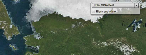
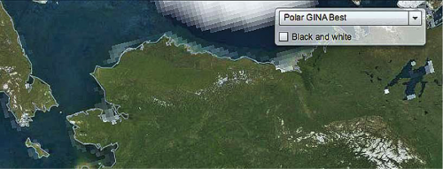
As an example, users can scroll through or graph 34 years of daily sea ice extent and thickness from the National Snow and Ice Data Center (NSIDC). This dataset shows the marked decrease in sea ice between October 1978 (top image, below) and October 2012 (bottom image, below).


Arctic Research Assets Map
This application was initially developed at the request of arctic researchers concerned that research equipment such as buoys and recorders may be hit or snagged by the increasing number of ships plying arctic waters. The map is intended to display the location of these assets, the funding source, and the implementing entity or research investigator. The map is searchable by sensor type, source, or study name. Metadata such as project information, deployment/pick-up dates, and key contacts is also available. Users can monitor plans of others prior to the field season and scroll through time to view instruments from past years. The tool is now widely used for planning purposes and to avoid duplication of efforts.
The AOOS data system employs interoperability systems, allowing data to be accessed and transmitted to geographically distributed research centers. Several tools are available through the AOOS website for data discovery, retrieval, staging, stacking, layering, and analysis. Those interested in submitting data to be included in the AOOS data system should contact AOOS at info [at] aoos.org.
AOOS Research Workspace
The new web-based research collaborative "AOOS Research Workspace" is a prototype, web-based data management solution for assembling, storing, and sharing data among members of the biological and physical oceanography communities. The workspace offers users an intuitive interface to create projects and upload data and descriptive literature. File transfer can be done through an easy "drag and drop" process.
Several groups are already using the workspace, including:
- North Pacific Research Board's Gulf of Alaska Integrated Ecosystem Research Program
- Gulf Watch Alaska, the long term monitoring program of the Exxon Valdez Oil Spill Trustee Council
- Herring Research and Monitoring Program, a collaborative effort of the Exxon Valdez Oil Spill Trustee Council implemented by the Prince William Sound Science Center
- Russian-American Long Term Census of the Arctic (RUSALCA)
For further information, see the AOOS website, or contact Molly McCammon (mccammon [at] aoos.org).
