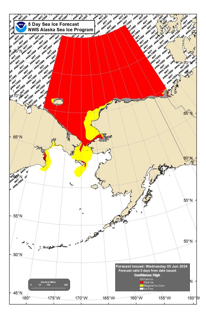
Assessment of Current Ice Conditions Relevant to Distribution and Access of Walrus
Click the name of each community below to view more frequently updated and detailed information from the National Weather Service.
Synopsis: A trough of low pressure along the west coast of Alaska will move west over the Dateline on Friday and then weaken. High pressure over the Chukotsk Peninsula of Russia will weaken on Friday then strengthen again over the weekend and persist into next week. A series of weather fronts will move from the Gulf of Alaska west over the southeast Bering Sea Friday through Monday. A low moving over the Seward Peninsula next Tuesday will weaken along the west coast of Alaska Wednesday and Thursday. Another low will move over the southeast Bering Sea next Friday.
Near St. Lawrence Island
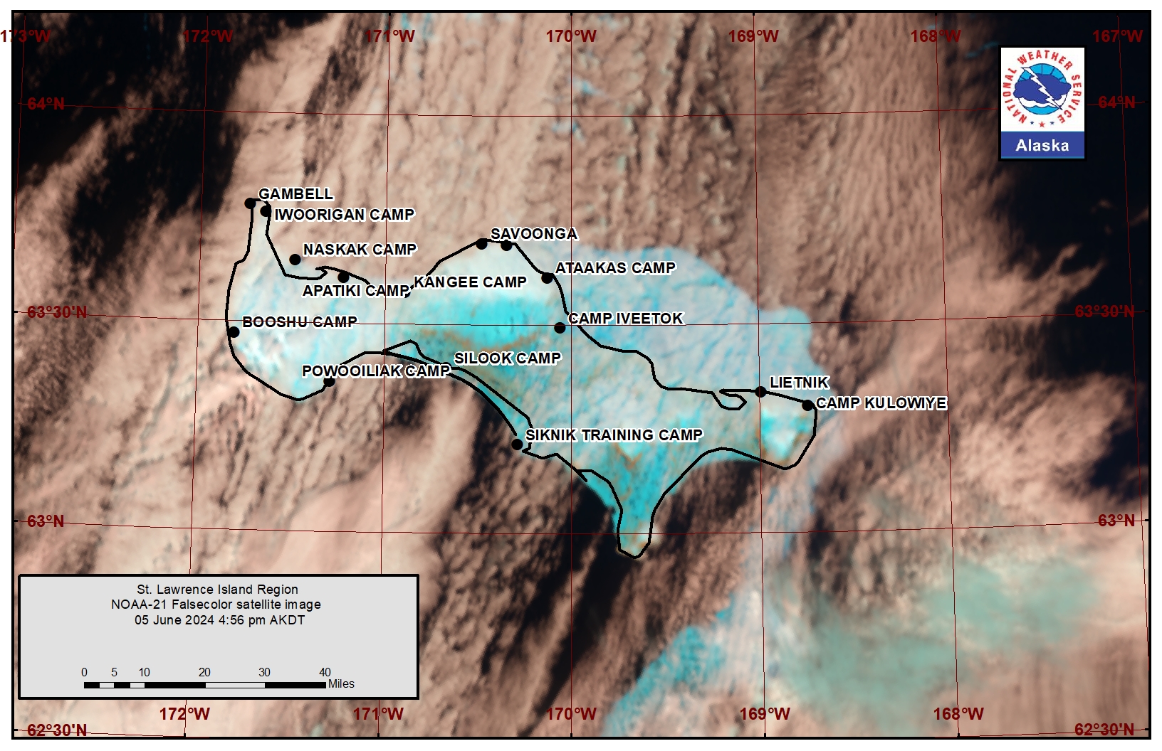
Ice-free conditions extend from Gambell southward around nearly the entire southern coastline of the island. The remaining pack ice in the area is compacted from east of Savoonga eastward through Camp Kulowiyi and flows around the east side of the island. It extends up to 20 miles (32 km) off of the northeastern coastline. There is an area of very open pack ice 25 miles (40 km) to the northeast of Gambell and 7 miles (11 km) northwest of Savoonga. Expect northerly winds to continue these conditions over the next week.
Nome
There is some lingering brash ice that was previously shorefast in the vicinity between Sledge Island and Nome, but is melting fast. Otherwise, Norton Sound is ice free.
Nome port entrance webcam (via AOOS webpage): https://bering-sea.portal.aoos.org/?ls=79875242-e362-65cb-914e-fed20ff9…
Brevig Mission/Port Clarence Area
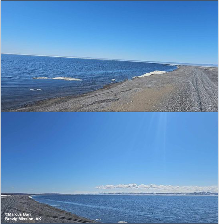
Shorefast ice remains within Port Clarence but has melted near Brevig Mission. It is likely close to the point where it is no longer shorefast. To the west of Port Clarence, open water extends to Wales and Ukivok with brash ice to ice cakes.
Wales to Shishmaref
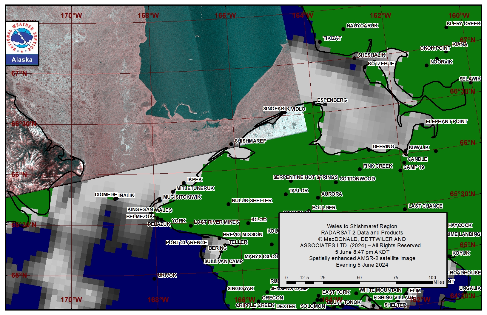
Shorefast ice extends up to 3 miles (4.8 km) offshore except up to 14 miles (23 km) offshore near Wales, with no changes over the last week. Beyond the shorefast ice is close pack ice to consolidated pack ice comprised of medium to big floes. Beyond the consolidated pack ice is a large polynya around 18 miles (29 km) northwest of Shishmaref, with open water to very open pack ice comprised of brash ice to small floes. Friday and Saturday, tides and currents will become the main mover of ice, bringing some open water or open pack ice northward through the Bering Strait. On Saturday through the remainder of the week, northerly winds will return the area to consolidated ice with a polynya extending from Kivalina.
Diomede
Some compact ice remains between the islands and extends 2 to 4 miles (3.2 to 6.4 km) northwest of Diomede. Close to very close pack ice is flowing through the Bering Strait and flowing around the west side of Big Diomede. There are anywhere from small to medium floes up to big to vast floes within. To the east and south of Diomede, the pack ice becomes open to very open pack with mostly small to medium floes, but there are some isolated big to vast floes. Friday and Saturday some of the close pack ice will unlock as winds lighten and tides and currents take hold. However, Sunday through the middle of the week, northerly winds will return the current situation to the Island.
Forecast Discussion
Ice Forecast
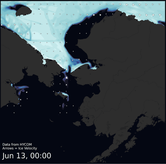
Ice will move with tides and currents as winds continue to lighten through Friday. On Saturday through Tuesday, expect the pack ice to begin to move southward again in persistent northerlies. Pack ice will continue to flow through the Bering Strait, thinning out to a marginal ice zone as it nears St. Lawrence Island. The remaining pack ice will continue to compact against the northeast side of St. Lawrence Island where it will flow around the east side, then down into the central Bering Sea to melt. Norton Sound will be completely ice-free by next week. Expect the polynya in the southern Chukchi Sea to continue to grow.
Wind Synopsis
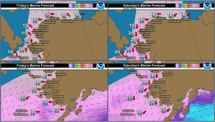
North 13 to 18 kt (14–20 mph) decreasing tonight, then becoming south 5 to 10 kt (5–11 mph) Friday. Saturday winds turning northeast and increasing to 15 to 25 kt (16–27 mph). Sunday, northeast winds decreasing to 10 to 20 kt (11–22 mph). Monday, northeast 5 to 10 kt (5–11 mph) increasing to 5 to 15 kt (5–17 mph). Tuesday and Wednesday, north winds 15 to 25 kt (17–28 mph). Thursday, northeast 10 to 20 kt (11–22 mph). Next week Friday, east 10 to 20 kt (11–22 mph).
Temperature Trend
Near 30 today (Thursday, 6 June), except near 40 near Nome. Friday in the 30s, except in the 40s near Nome. Saturday warming into the 40s except near 60 near Nome. Sunday through next Friday in the lower 30s to lower 40s, except lower 40s to lower 60s near Nome.
Daily Weather, Wind, and Temperature Updates
The National Weather Service provides twice-daily, text only updates on the weather, wind, and temperature conditions in specific geographical zones. An interactive weather map for access to other Alaskan zones can be found here: http://weather.gov/anchorage/ice
Higher resolution satellite images and wind maps (wind updated daily) can be viewed here: http://www.weather.gov/afg/SIWO_overview
The Alaska Ocean Observing System shares a variety of weather and sea ice related resources in their Bering Sea Portal at https://bering-sea.portal.aoos.org/.
Marine forecast for the West Coast and Arctic Coast
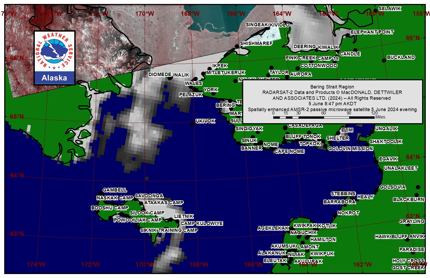
Remote Sensing Images
Observations and Comments
Observations of Sea Ice Development
Observations from Savoonga
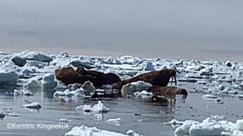
Thursday, 6 June 2024 – Kendric Kingeekuk
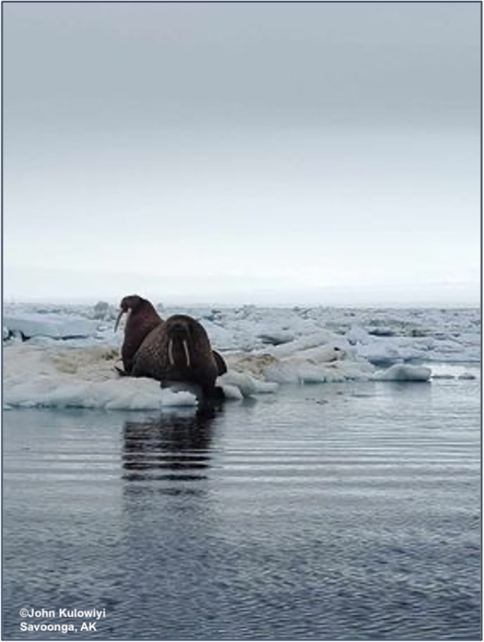
Friday, 7 June 2024 – John Kulowiyi
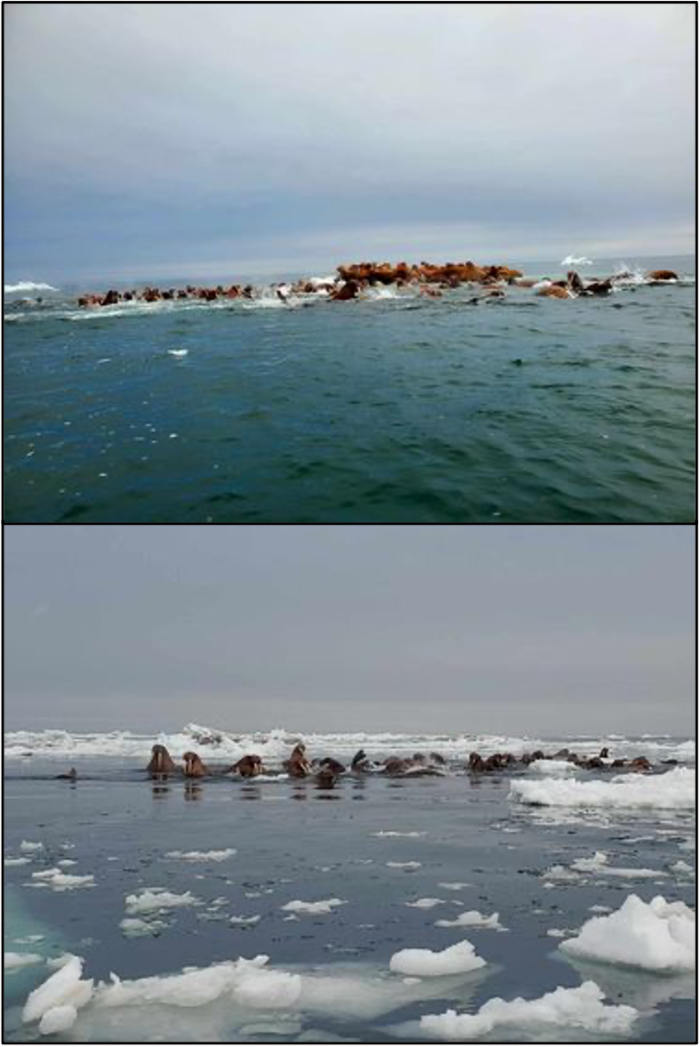
Friday, 7 June 2024 – Aqef Waghiyi
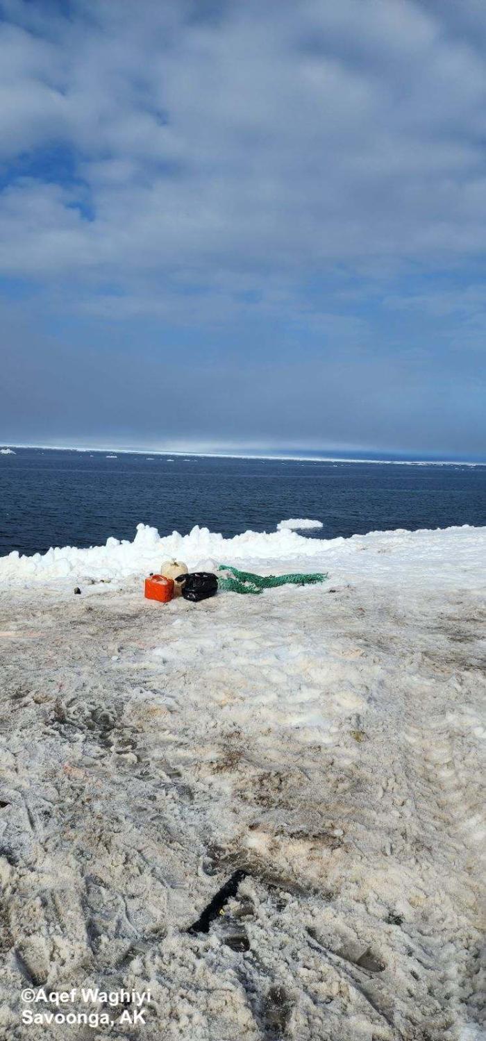
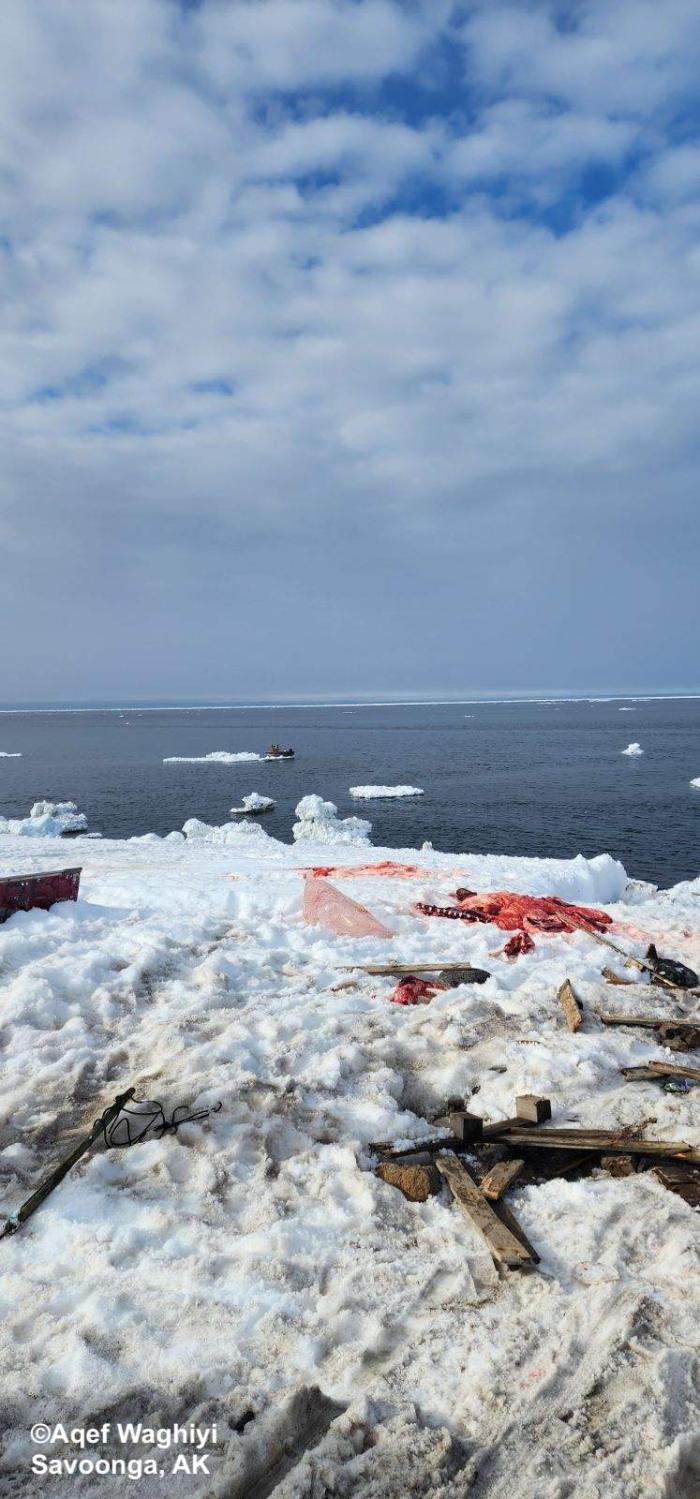
Wind from east at 17 knots, 37 degrees, barometer 1020.9, dew point 33.8, humidity 61.2, wind chill 29 degrees. Boats went out and got walrus, some got females with calf. Can hear Gambell boats talking on vhf. Gambell boats were 19 miles north of Savoonga.
Observations from Diomede (Inaliq)
Friday, 7 June 2024 – Marty Eeleengayouq Ozenna
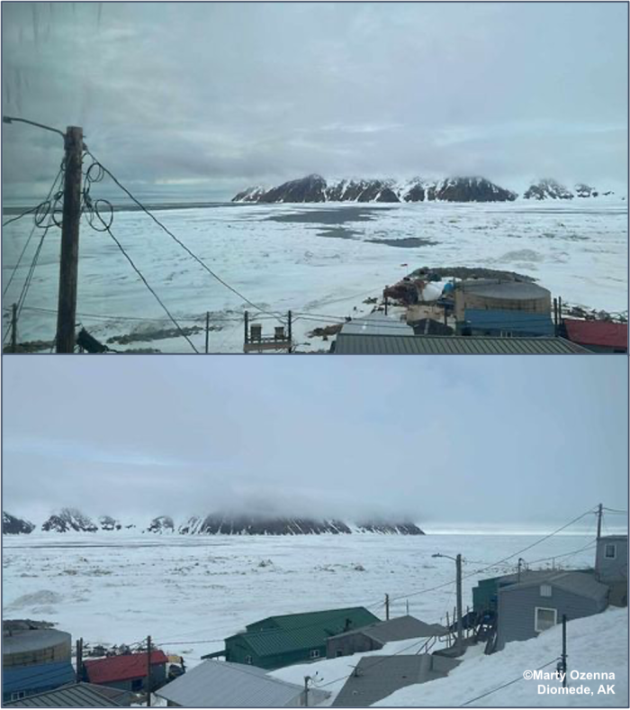
We’re about 30–35 knots north wind and the ice has open spots going up north.
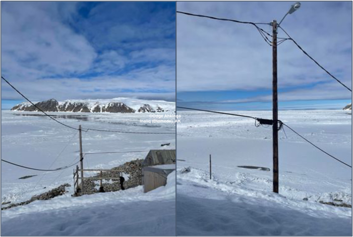
Friday, 7 June 2024 – Odge Ahkinga
For Inaliq finally open leads for start hunting. Boats are ready. We still have shore ice between the islands.
Observations from Shishmaref
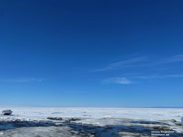
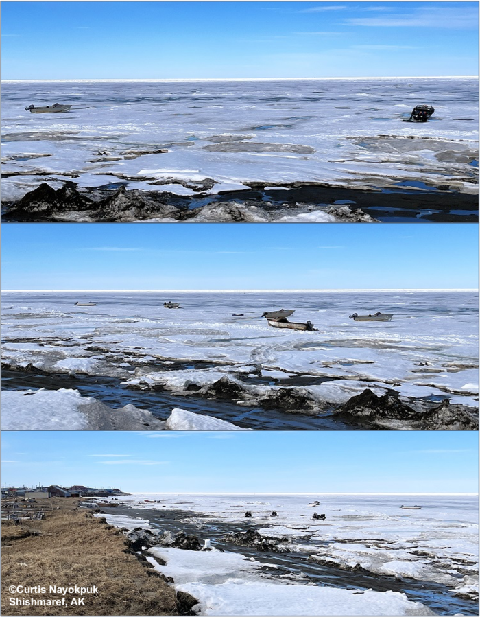
Friday, 7 June 2024 – Corey Ningeulook
Calm weather, boats haven’t been out in a few weeks due to no trail out.
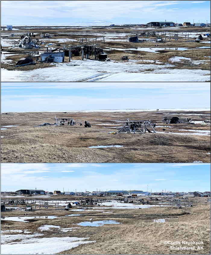
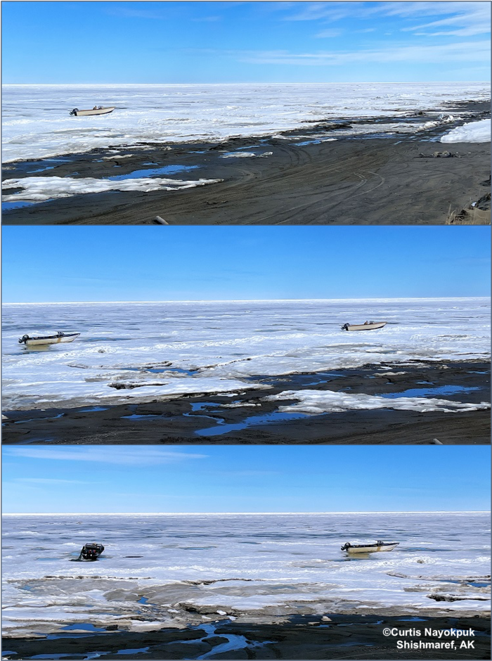
Sunday, 9 June 2024 – Curtis Nayokpuk
Shorefast ice deteriorating and forecast northerly winds all week will leave hunters a last chance to snowmobile out around "black ice" to hunt Oogurks sleeping on warm sunny days. Subsistence camps are busy with family outings enjoying good weather.
Observations from Port Clarence, Brevig Mission, and Cape Douglas
Friday, 7 June 2024 – Marcus Barr
Shorefast ice moved out the past week after strong gusty north winds for quite a few days. Hunters had a successful hunt this spring.
Observations from Wales
*Friday, 7 June 2024 – Abel Apatiki
Just wanted to share this like 10 miles towards Little Diomede.
Video shared by Abel Apatiki, Wales, Alaska
Additional Comments Provided by Local Experts and Other Contributors
Shared by the Alaska Ocean Observing System (AOOS) for 5-13 June 2024
Visit the SIWO Facebook page @seaiceforwalrus to view this animation showing the predicted movement of ice predicted by the HYbrid Coordinate Ocean Model (HYCOM). Snapshots from the forecast show ice coverage from 0% (black) to 100% (white) and arrows show the relative speed and direction of the ice. A light boundary is drawn at 15% predicted ice cover to highlight the ice edge, but ice may be predicted to extend beyond it. Some bays, lagoons, and areas very close to shore are not covered by the model. (Image produced by the Alaska Ocean Observing System / Axiom Data Science).

