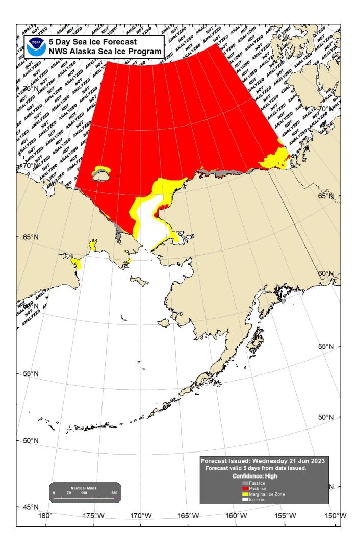
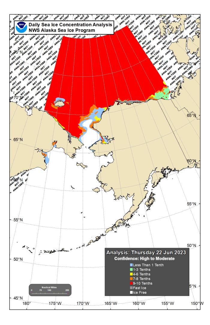
Assessment of Current Ice Conditions Relevant to Distribution and Access of Walrus
Click the name of each community below to view more frequently updated and detailed information from the National Weather Service.
Synopsis: Two low pressure systems develop Friday and through the weekend. One in the southern Bering Sea and the second in the Chukchi Sea. Expect those lows to linger before weakening on Monday.
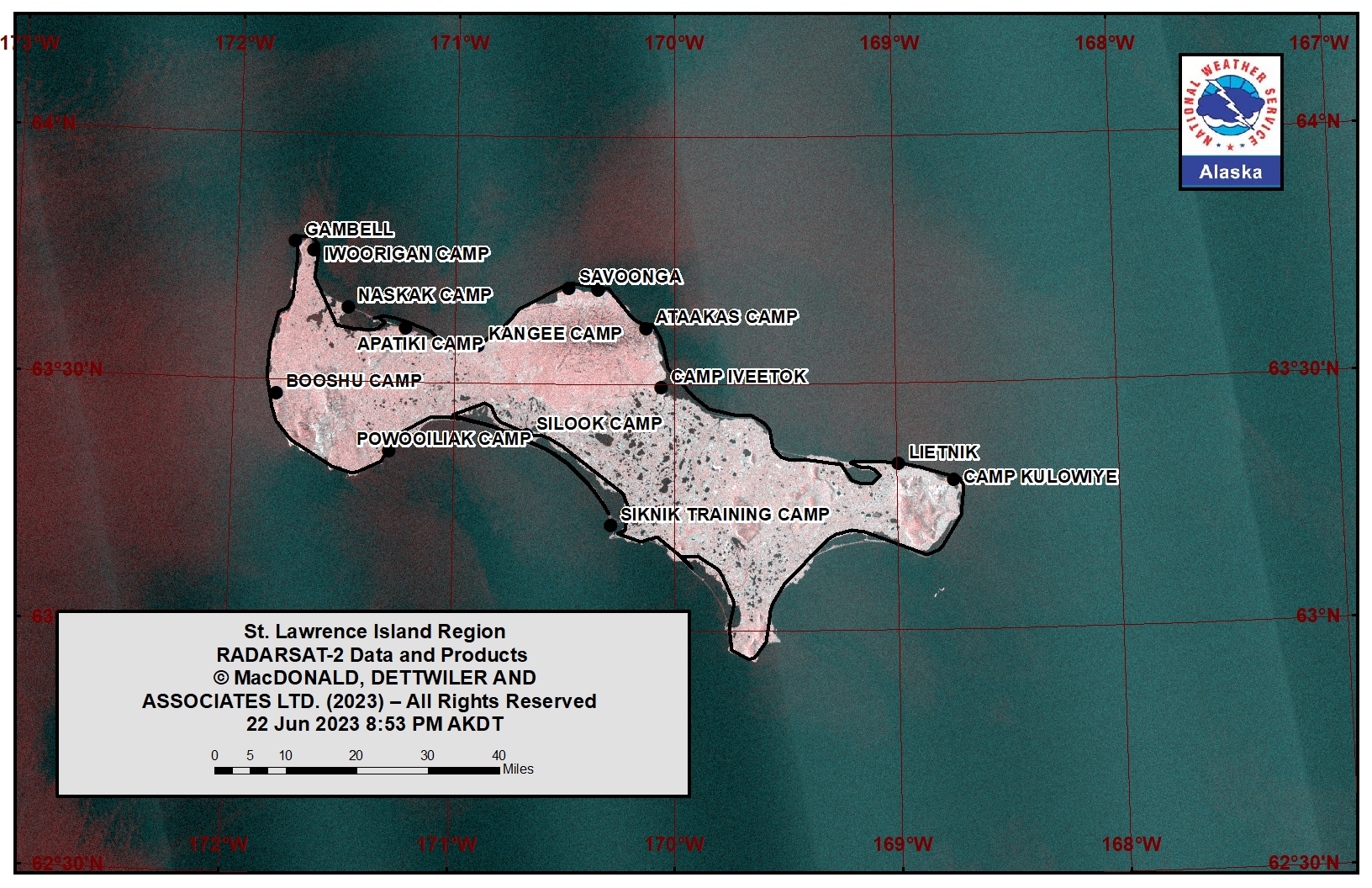
Near St. Lawrence Island
This area is ice-free and the forecast period has ended for this season.
Nome
This area is ice-free and the forecast period has ended for this season.
Brevig Mission/Port Clarence Area
The area is quickly approaching ice-free. There is a strip of open pack ice 5 miles (8 km) south of Brevig Mission. Otherwise, remaining ice is along the south-facing coastline from 6 miles (10km) west of Brevig Mission to 28 miles (45 km) west of Brevig Mission.
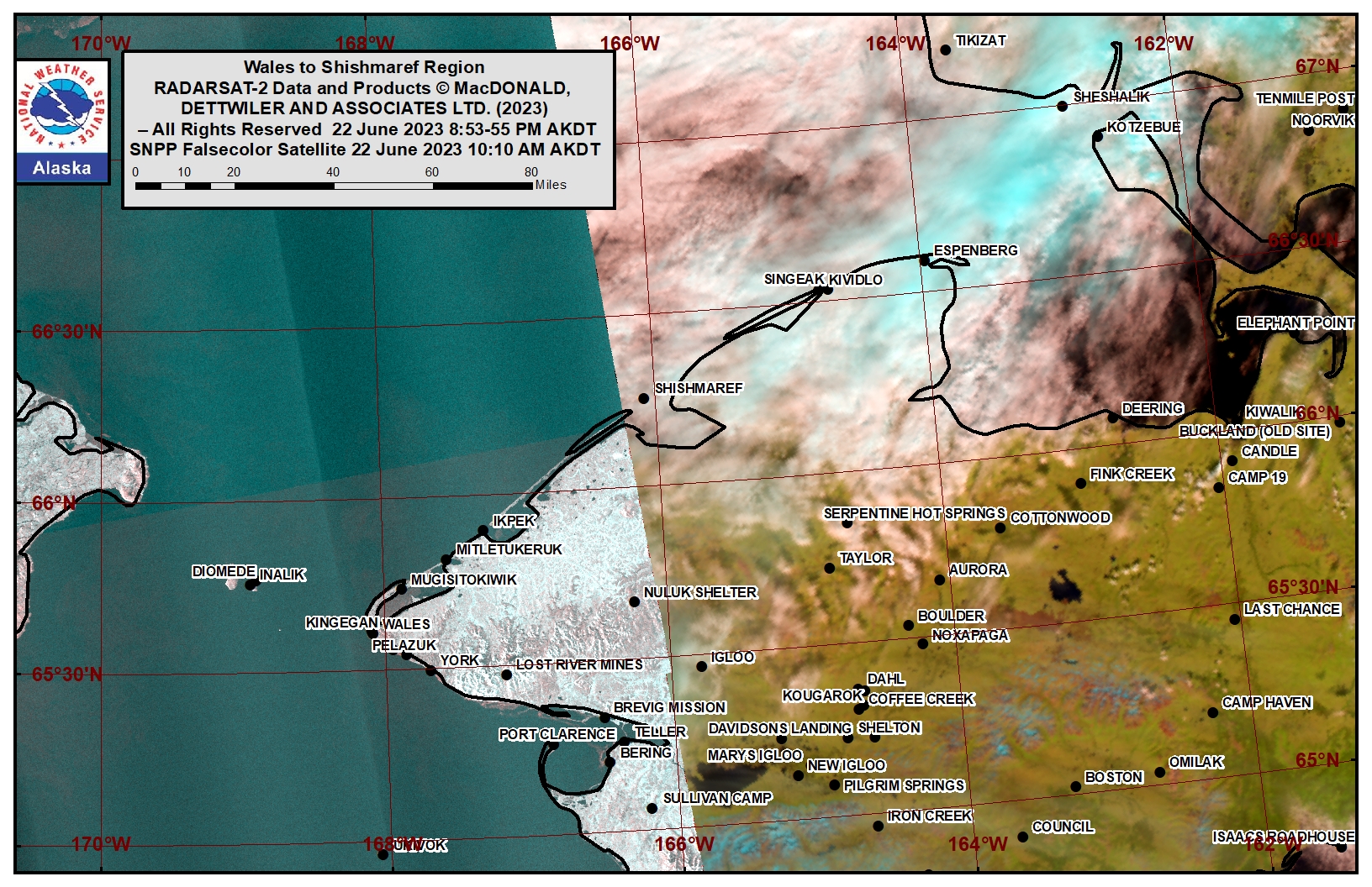
Wales to Shishmaref
Off the coast from Wales to Shishmaref remains near ice-free. Ice remains within lagoons and protected areas near Wales and Shishmaref.
Diomede
This area is ice-free and the forecast period has ended for this season.
Forecast Discussion
Ice Forecast
For Brevig Mission/Port Clarence, expect the remaining ice to melt and for this area to likely be ice-free by next week.
For Wales to Shishmaref, expect the remaining ice within lagoons and protected areas to melt and for this area to continue to approach ice-free conditions.
Wind Synopsis
At Shishmaref, northeast winds of 5 to 8 knots (5 to 9 mph) will shift to the northwest on Saturday and then shift to the north and increase to 9 to 11 knots (10 to 13 mph) on Sunday. Winds shift to the west Sunday night and increases to 15 to 20 knots (17 to 23 mph) on Monday diminishing to 8 to 12 knots (9 to 14 mph) on Tuesday, and then shifting to west northwest on Wednesday, and then persists.
At Wales, south winds of 5 to 8 knots (5 to 9 mph) will prevail through Saturday shifting to the northeast and increasing to 10 to 13 knots (12 to 15 mph) on Sunday. Winds shift to the northwest and diminish Monday to 6 to 8 knots (7 to 9 mph), shifting to the southwest on Tuesday. On Wednesday, south winds of 8 to 10 knots (9 to 12 mph) will shift back to the north late in the day and increase to 12 to 15 knots (14 to 17 mph) on Thursday.
For the Brevig Mission and Port Clarence area, light and variable winds will prevail on Friday, shifting to the south 5 to 7 knots (5 to 8 mph) on Saturday and then to the northeast on Sunday. On Monday, winds shift to the south and increase to 7 to 11 knots (8 to 13 mph), becoming southwest 6 to 8 knots (7 to 9 mph) on Tuesday. Winds become light and variable Tuesday night and Wednesday, becoming north Wednesday night and increasing to 8 to 10 knots (9 to 12 mph), and increasing further to 9 to 14 knots (10 to 16 mph) on Thursday.
Temperature Trend
Temperatures will remain fairly consistent throughout the week. High temperatures will be in the mid 40s to near 50 and low temperatures will be in the upper 30s to lower 40s.
Daily Weather, Wind, and Temperature Updates
The National Weather Service provides twice-daily, text only updates on the weather, wind, and temperature conditions in specific geographical zones. An interactive weather map for access to other Alaskan zones can be found here: http://weather.gov/anchorage/ice
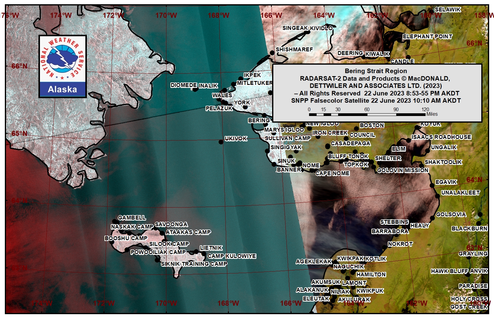
Higher resolution satellite images and wind maps (wind updated daily) can be viewed here: http://www.weather.gov/afg/SIWO_overview
The Alaska Ocean Observing System shares a variety of weather and sea ice related resources in their Bering Sea Portal at https://bering-sea.portal.aoos.org/.
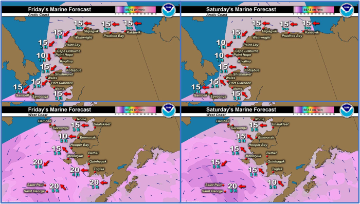
Marine forecast for the West Coast and Arctic Coast
Remote Sensing Images
Observations and Comments
Observations of Sea Ice Development
Observations from Diomede
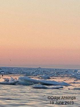
Monday, 19 June 2023 – Odge Ahkinga
This ship was too close couple days ago while we were hunting. We can hear its engines and we stop seeing oogruq.
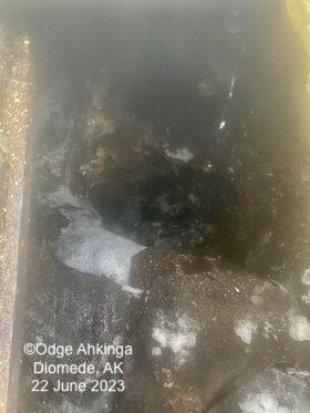
Friday, 23 June 2023 – Odge Ahkinga
My meat hole in Diomede no longer has permafrost to ferment walrus meats. The pit is down 15 feet. I was really looking forward to preparing our delicious fermented foods.
Observations from Port Clarence, Brevig Mission, and Cape Douglas
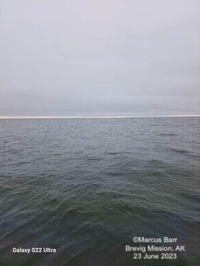
Friday, 23 June 2023 – Marcus Barr
Shorefast ice broke up and is moving out fast. Beach ice is lingering around for little bit but going out also. Very little to no ice out there. No walrus has been harvested but 1 maybe. Hunters are still trying to get walrus but slowly giving up on the hunting this spring.
Observations from Savoonga
Friday, 23 June 2023 – Aqef Waghiyi
We have been seeing young bearded seals every boating trip. And one boat seen couple bull walrus in the water but never see em again. Foggy here today humidity at 100%, wind from west at 10 knots. Barometric pressure is at 990. Few boats are going to the cliffs to get bird eggs.

