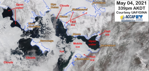
Assessment of Current Ice Conditions Relevant to Distribution and Access of Walrus
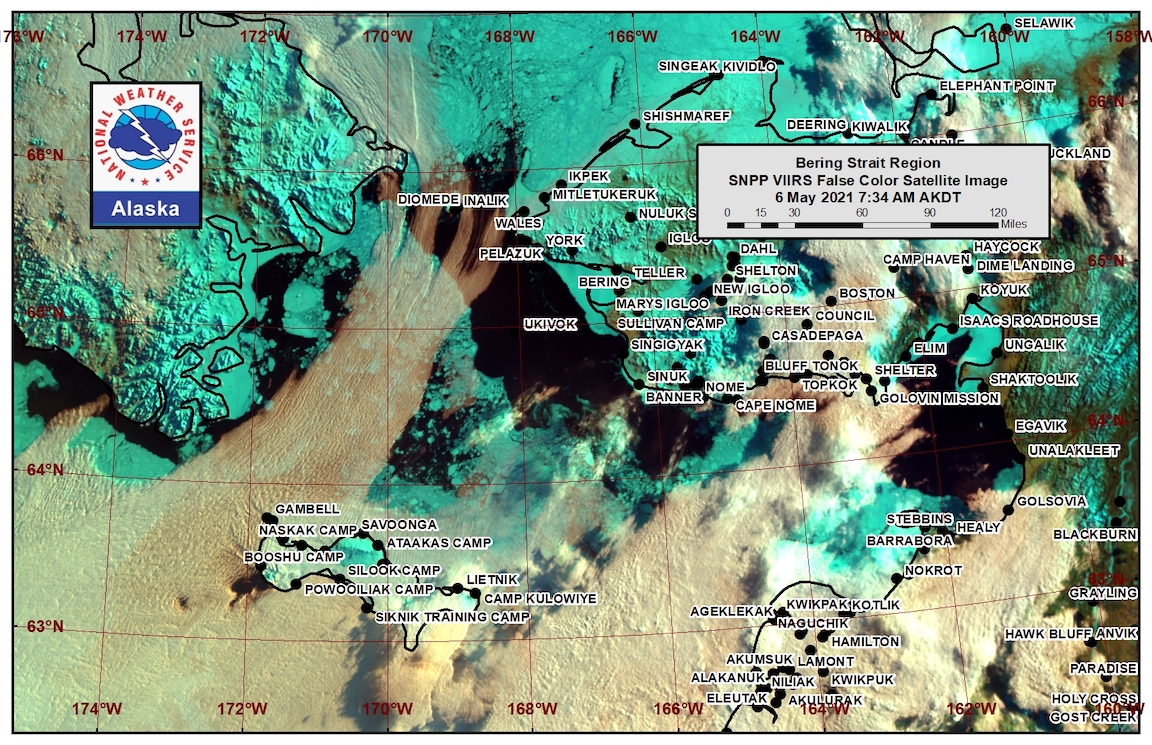
Click the name of each community below to view more frequently updated and detailed information from the National Weather Service.
Synopsis – A low pressure system will remain in the eastern and southern Bering Sea through the week. High pressure will remain over the Arctic, which will keep offshore flow going for the next week.
Near St. Lawrence Island
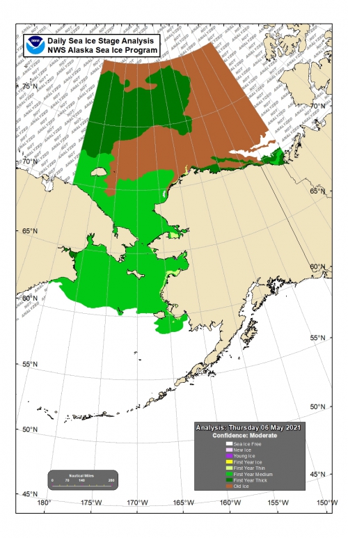
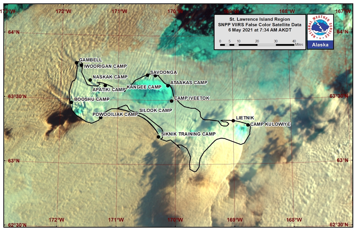
There is shorefast ice, mainly on the north and east side of St. Lawrence Island, generally extending 1 to 2 miles offshore. There is no shorefast ice remaining on southern shores. Beyond the shorefast ice on the north and east sides of the island is compact pack ice to consolidated ice consisting of medium to vast floes.
There is a large polynya south of the island that extends 40 to 60 miles away from the island. It is mainly open water. Beyond that polynya is close pack ice consisting of medium to vast floes. There is also a polynya off the west coast that stretches 15 to 30 miles, with close pack ice consisting of medium to vast floes beyond that.
Nome
Shorefast ice around the Nome area extends up to 2 miles offshore from Sinuk to near Solomon, and up to 7 miles offshore near Cape Rodney out to Sledge Island. The polynya offshore from Port Safety to Nome extends 1 to 2 miles off the shorefast, opening up 20 to 35 miles toward Sledge Island. Close to very close pack ice exists off the polynya from Nome to Port Safety with medium to vast floes.
Brevig Mission/Port Clarence Area
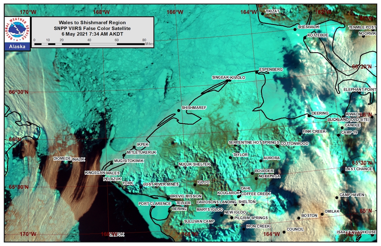
Shorefast ice remains intact and extends 23 to 25 miles west/southwest of Brevig Mission. There is a large polynya that extends off the shorefast ice up to 50 miles, however there is an area of open to very open pack ice that runs from 5 to 20 miles off the shorefast ice. It consists of decaying ice from brash up to medium floes.
Wales to Shishmaref
Shorefast ice extends up to 2.5 miles from the coast. Beyond the shorefast ice is consolidated ice consisting of medium to giant floes.
Diomede
Shorefast ice persists between the islands. There is consolidated ice to the north of the shorefast that extends around 2.5 miles. There is a polynya that extends up to 5 miles south of the shorefast ice. Otherwise, open water to very open pack ice surrounds the island with medium to big floes.
Forecast Discussion
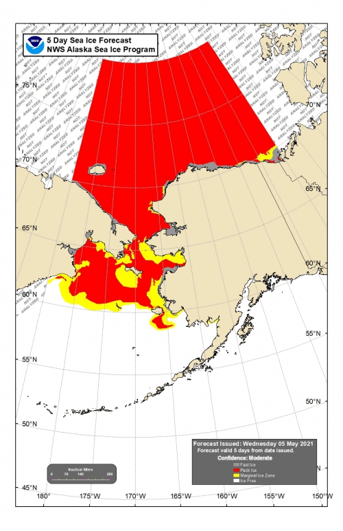
Ice Forecast
Continued offshore flow will move the ice mainly to the southwest, 20 to 30 miles through Friday, May 14th. Polynyas will continue to grow. Thinner sea ice between thicker ice floes will continue to melt through the week.
Wind Synopsis
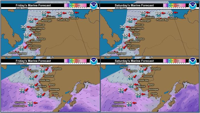
Northeast winds 5 to 15 kt (6 to 17 mph) will persist across the Bering Strait region Friday, May 7th through Monday, May 14th. Winds will diminish and become mainly variable 5 to 10 kt (6 to 11 mph) Monday evening through Tuesday, May 11th. By Wednesday, May 12th, northeast winds will increase to 15 to 20 kt (17 to 23 mph) from the Bering Strait to St. Lawrence Island and persist through Friday, May 14th. During this same period, winds will be a bit lighter near Shishmaref and along the southern Seward Peninsula coast at Nome, with east to northeast winds 5 to 10 kt (6 to 11 mph).
Temperature Trend
Temperatures will remain relatively steady through the week. High temperatures Friday, May 7th through Friday, May 14th will be mainly in the 30's, except in the 40's from Teller to Nome. Overnight low temperatures will be in the 20's and 30's, with the warmest readings near Nome.
Daily Weather, Wind, and Temperature Updates
The National Weather Service provides twice-daily, text only updates on the weather, wind, and temperature conditions in specific geographical zones. An interactive weather map for access to other Alaskan zones can be found here: http://weather.gov/anchorage/ice
Higher resolution satellite images and wind maps (wind updated daily) can be viewed here: http://www.weather.gov/afg/SIWO_overview
Marine forecast for the West Coast and Arctic Coast
Remote Sensing Images
Observations and Comments
Observations of Sea Ice Development
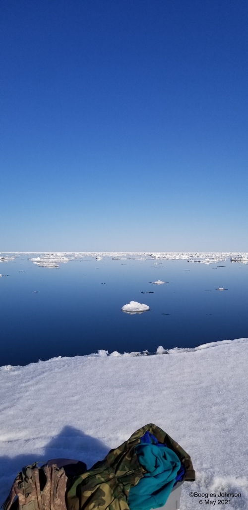
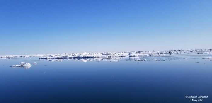
Observations from Nome
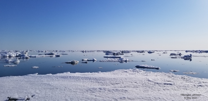
6 May 2021 – Boogles Johnson
The sea ice is moving in the Nome area. Our shore fast ice is breaking off closer to the shore, last night there was a piece approx. 6 miles long that just broke off. I was able to head out hunting yesterday and the sea ice is ideal for Walrus & Seals now. We have not had many waves yet so the Pan ice is still mainly in pans. Yesterday was glass calm and a perfect day to be on the ocean. I have heard that several crews have successfully landed Walrus, Oogruk (bearded seals) and seals.
Observations from Gambell
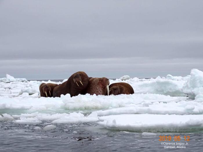
6 May 2021 – Clarence Irrigoo, Jr.
Bigger ice floe getting smaller, boats that went out got walrus and seals. The open water is rough out there.
Observations from Savoonga
7 May 2021 – Aqef Waghiyi
No open water close by. Kinda foggy out today. Few boats at south side, got walrus. Nothing new happened. Foggy, low ceiling for pictures but will send some if it clears.
Observations from Port Clarence and Brevig Mission
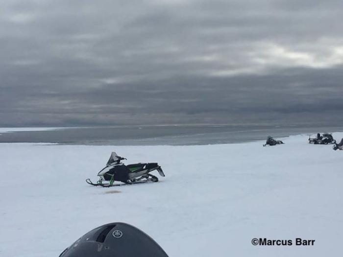
6 May 2021 – Marcus Barr
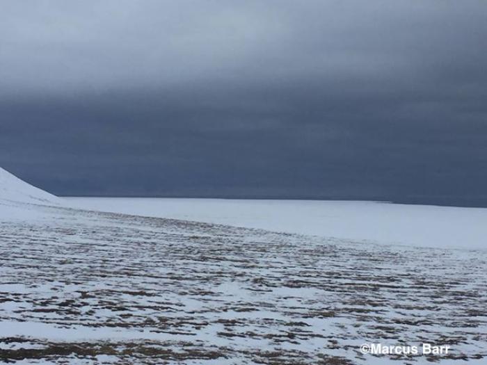
Same update as last week, no change besides snow melting on ice and a boat from Brevig and Teller launched about 35 miles from Brevig. I got some aerial photos from my flight from Nome to Brevig this afternoon. Ice edge is all the way to the beach at Wooly lagoon about 35–40 miles SW of Brevig. Ice edge from Douglas is about 4 miles out.

Observations from Diomede
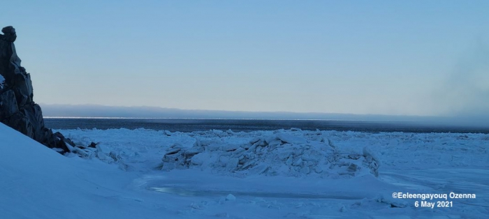
6 May 2021 – Marty Eeleengayouq Ozenna
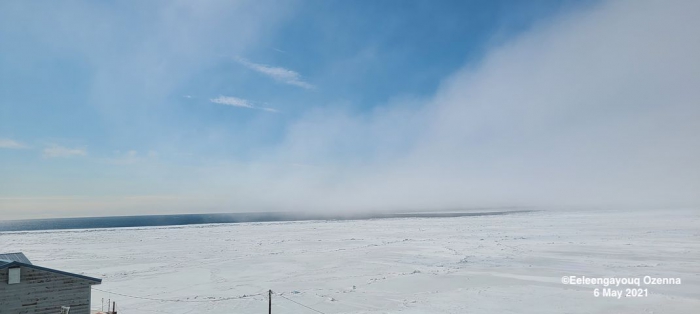
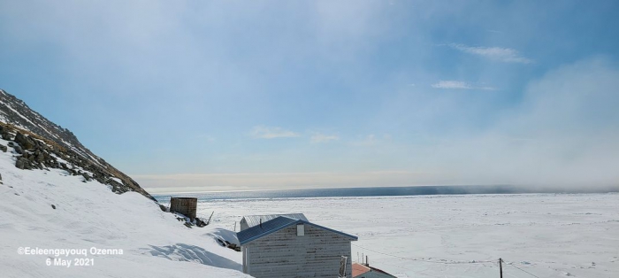
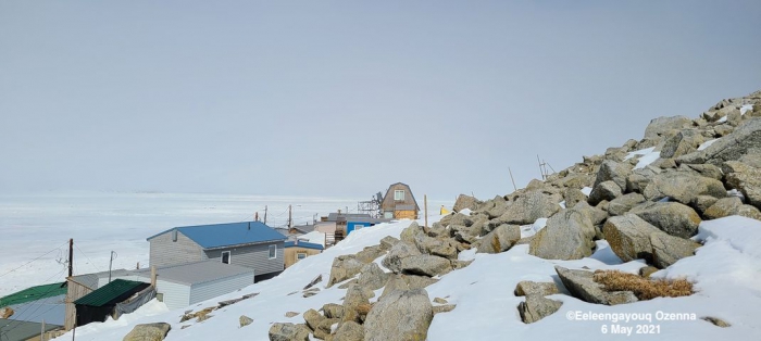
We’re pretty opened to the south of the village since this morning, still open and closing up north of the island slowly dying down. The dark picture was from this morning’s walk to the south edge around 7:15 am, there was lots of game passing just a bit too far out also couple flocks of cranes were passing by.
Observations from Shishmaref
9 May 2021 – Curtis Nayokpuk
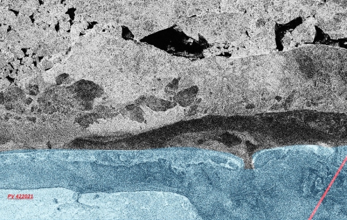
Fog (almost) daily limiting safe travel to open leads. Last report 12:30 AM 5/9/2021 from returning hunters they could not make it to leads 10-13 miles NW out from shore fast ice (open leads black on Polar View from a week ago) due to fog and rough jumbled ice (white) and dark thin ice of 3 in. to 6 in. covered with fog -ice frost. Polar View shows dark solid shore fast ice along beach with "white" 18 to 20 in. thick jumbled ice and large 3-6 in. thin dark ice areas frozen in past couple months.
Additional Comments Provided by Local Experts and Other Contributors
Shared by Rick Thoman, ACCAP
5 May 2021
Here's the zoomed-in, annotated version of the May 4th satellite image.
