Assessment of Current Ice Conditions Relevant to Distribution and Access of Walrus
Near St. Lawrence Island
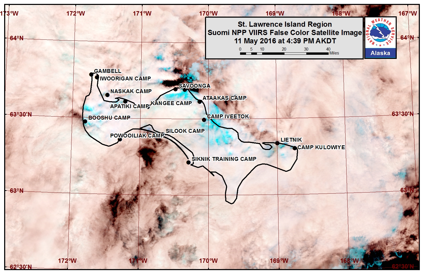
Sea ice along the northern coastline of St. Lawrence Island has changed rapidly in the past week. Shorefast ice remains along the northern coastline extending offshore up to 5 nm. Beyond the shorefast ice of the northern coast lies a polynya with very open pack ice consisting of first year ice floes. Beyond the polynya lies a region of open to close pack ice. Open water currently lies off the coast near Gambell with open pack ice drifting with the winds and ocean currents further offshore. Belts of ice are being pulled down past the east coast of the island with open to close pack ice. Rotting first year ice floes are currently drifting past the southern coastline of the island. These ice floes are low riding in the water and are expected to melt out rapidly in the coming week.
Wales to Shishmaref
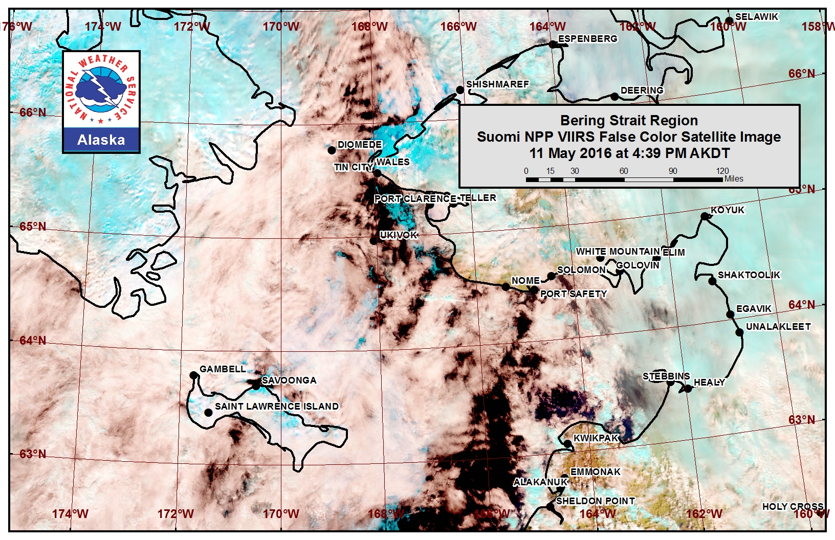
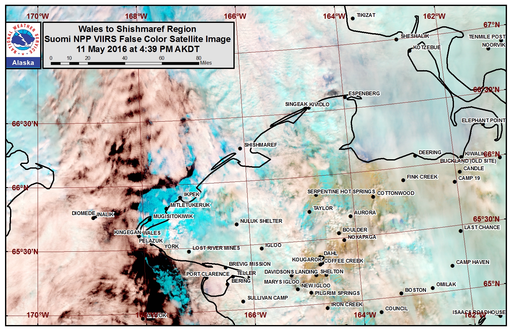
Shorefast ice along the coast from Wales to Shishmaref remains in place at this time stretching up to 10 nm offshore near Mugisitokiwik and approximately 2 nm offshore near Shishmaref. Beyond the coastline from Tin City to Wales lies an area of open water with first year floes drifting past. Beyond the shorefast ice from Mugisitokiwik to Ikpek lies a region of very open pack with first year floes, while beyond the shorefast ice from Ikpek to Shishmaref lies a region of close pack ice consisting of first year floes. A very narrow polynya with isolated first year ice floes has opened near the coastline approximately from Shishmaref to Espenberg. Much of the eastern half of the Bering Strait is sea ice free or open water at this time, and the main ice pack in the southern Chukchi Sea continues to collapse with first year floes breaking apart and shifting at this time.
Forecast Discussion
Ice Forecast
For the St. Lawrence Island region we expect the shorefast ice along the northern coastline of the island to continue to destabilize through May 14th with the southerly wind flow. During this time the polynya offshore will continue to expand to the north and the close pack ice will continue to spread to the north. As northerly flow returns May 15th, we expect the polynya off the shorefast ice to the north to close and pack ice to continue shifting down past the east and west coasts of the island.
For the Wales to Shishmaref region we expect the outer edges of the shorefast ice to slowly continue to destabilize in the coming week. Polynyas will continue to form off the shorefast ice edge through May 14th. As the northerly wind flow returns the polynyas will close and open to close pack ice consisting of first year ice floes will drift in closer to the coast.
Weather System/Wind Synopsis
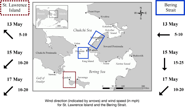
Surface high pressure developing over St Lawrence Island and the Bering Strait on Friday will bring general southeast flow over St Lawrence Island of 5 to 10 mph (4-9 knots) and easterly flow over the Bering Strait of 5 to 10 mph (4-9 knots) . Increased winds will develop the evening of May 14th and persist through May 18th over the Bering Strait and St Lawrence Island as high pressure will slowly shift to the west as a surface low pressure will develop over Mainland Alaska. Expect northerly flow of 10-20 mph (9-18 knots) with periodic wind gusts of 25 to 35 mph (20-30 knots) between May 15th and May 18th as a result.
Temperature Trend
Generally above normal temperatures will persist through May 21st. Daytime temperatures will range around 30 to 40 degrees initially then increase to 35 to 45 degrees after May 15th. Overnight temperatures of 25 to 35 degrees can be anticipated.
Daily Weather, Wind, and Temperature Updates
The National Weather Service provides twice-daily, text only updates on the weather, wind, and temperature conditions in specific geographical zones:
For Shishmaref: http://pafc.arh.noaa.gov/fpopcap/lfpfcst.html?z=AKZ207
For Wales, Gambell, and Savoonga: http://pafc.arh.noaa.gov/fpopcap/lfpfcst.html?z=AKZ213
An interactive map for access to other Alaskan zones: http://pafc.arh.noaa.gov/fpopcap/?leaf=1
Marine forecast for the West Coast and Arctic Coast

Remote Sensing Images


Observations and Comments
Observations of Sea Ice Development
Observations from Shishmaref
13 May 2016 - Curtis Nayokpuk
Rain and warm, southerly winds are melting snow cover and opening leads up 5 to 6 miles north. Hunters are working to get boats ready and moved to beach front for travel to open leads when offshore winds subside. Forecast of fog, snow, and winds shifting to northwest may delay boat hunts and hunters will be out with snowmobiles looking for Bearded Seals along open leads.
