Assessment of Current Ice Conditions Relevant to Distribution and Access of Walrus
Near St. Lawrence Island
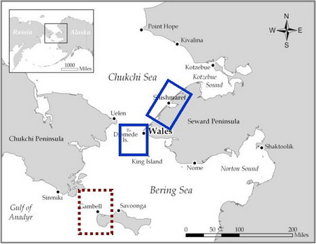
High pressure continues to persist over the northern Chukchi Sea, producing consistent northerly winds. The northerly winds have pushed some of the ice pack down on the north shore of St. Lawrence Island, west of Savoonga. Otherwise, except for some narrow shorefast ice along some of the shores, the waters northwest, west, and south of St. Lawrence Island are open with widely scattered small floes still present. The major ice pack still exists east and southeast of St. Lawrence Island where there is a mix of floe types and sizes. The open waters around St. Lawrence Island continue to warm, helping what ice is left to melt.
Wales to Shishmaref
There is still some shorefast ice off Wales. Offshore the waters are open with widely scattered floes. The flow of warm water through the Bering Strait has helped to melt the ice pack so that the central portion of the Strait is now open. The shorefast ice off Shishmaref is beginning to break up. Satellite imagery shows large areas of open water within the shorefast ice, especially to the east of Shishmaref. However, the persistent northerly wind is still tending to hold the ice against the coast.
5 and 10 Day Outlook: June 2 to June 7
Northerly winds will continue to persist over the northern Bering Sea and Strait. With the presence of high pressure, there will be many days of sunny and/or partly sunny days. Northerly winds will increase over the weekend and into the first days of next week. Winds can be as strong as 30kt. However, after June 5, the northerly winds will decrease and by the 7th should be near 15kt. "Last ice" still remains in the southern portion of the Gulf of Anadyr.
Arrows show wind direction and wind speed in knots


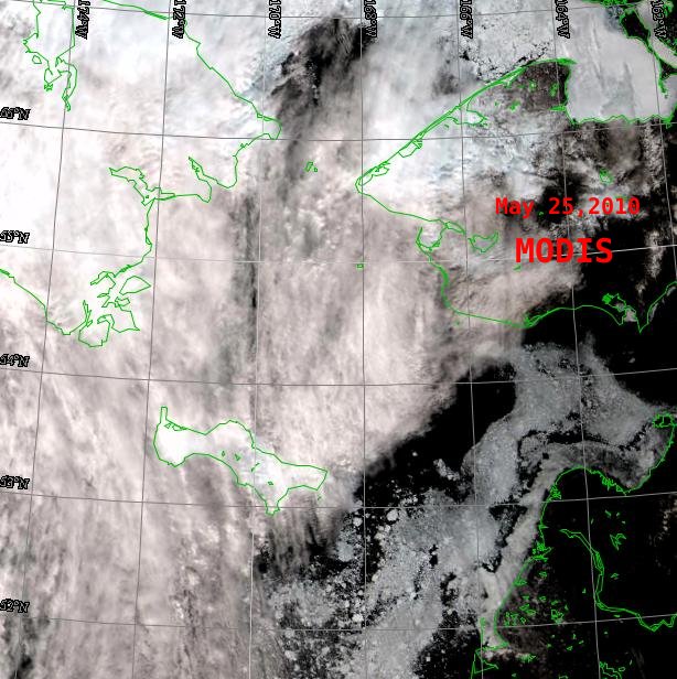
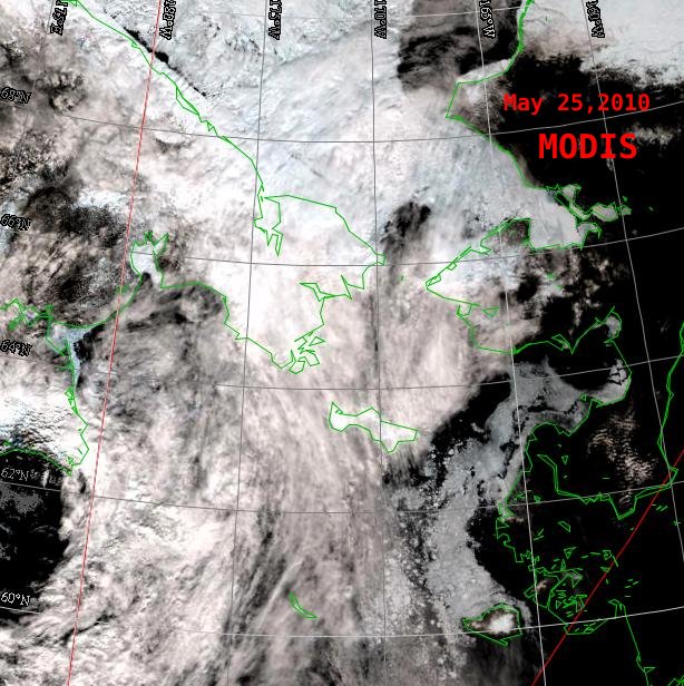
Remote Sensing Images


Observations and Comments
Observations of Sea Ice Development
28 May 2010 - Hajo Eicken - Ice conditions from radar satellite images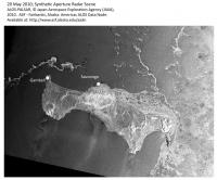
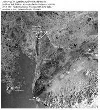 The radar satellite images (right: St. Lawrence Island region; left: Bering Strait region) from May 20, though a bit older, provide very good detail on the distribution of ice as the ice retreats to the North (see Winton Weyapuk's comments as well).
In the Bering Strait region, landfast ice persisted into late May, including the large tongue of landfast ice held in place between Wales and Shishmaref. One of the drifters released from Wales got trapped behind this landfast ice is near-stationary (see drifter map under "additional information on ice conditions"), while the other sea ice moves to the North. A coastal radar at Wales is also capturing this northward movement well (http://seaice.alaska.edu/gi/observatories/wales_radar).
With retreating ice, off Gambell mostly bands of ice with smaller floes remain. East of Savoonga, much ice remains nearshore with ice drifting north east of the island as well. As near Wales, there is still some landfast ice left in place between Savoonga and Gambell.
28 May 2010 - Hajo Eicken - Ice conditions from radar satellite images
 The radar satellite images (right: St. Lawrence Island region; left: Bering Strait region) from May 20, though a bit older, provide very good detail on the distribution of ice as the ice retreats to the North (see Winton Weyapuk's comments as well).
In the Bering Strait region, landfast ice persisted into late May, including the large tongue of landfast ice held in place between Wales and Shishmaref. One of the drifters released from Wales got trapped behind this landfast ice is near-stationary (see drifter map under "additional information on ice conditions"), while the other sea ice moves to the North. A coastal radar at Wales is also capturing this northward movement well (http://seaice.alaska.edu/gi/observatories/wales_radar).
With retreating ice, off Gambell mostly bands of ice with smaller floes remain. East of Savoonga, much ice remains nearshore with ice drifting north east of the island as well. As near Wales, there is still some landfast ice left in place between Savoonga and Gambell.
