Assessment of Current Ice Conditions Relevant to Distribution and Access of Walrus
Near St. Lawrence Island
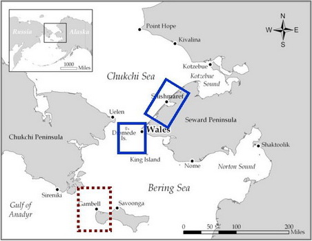
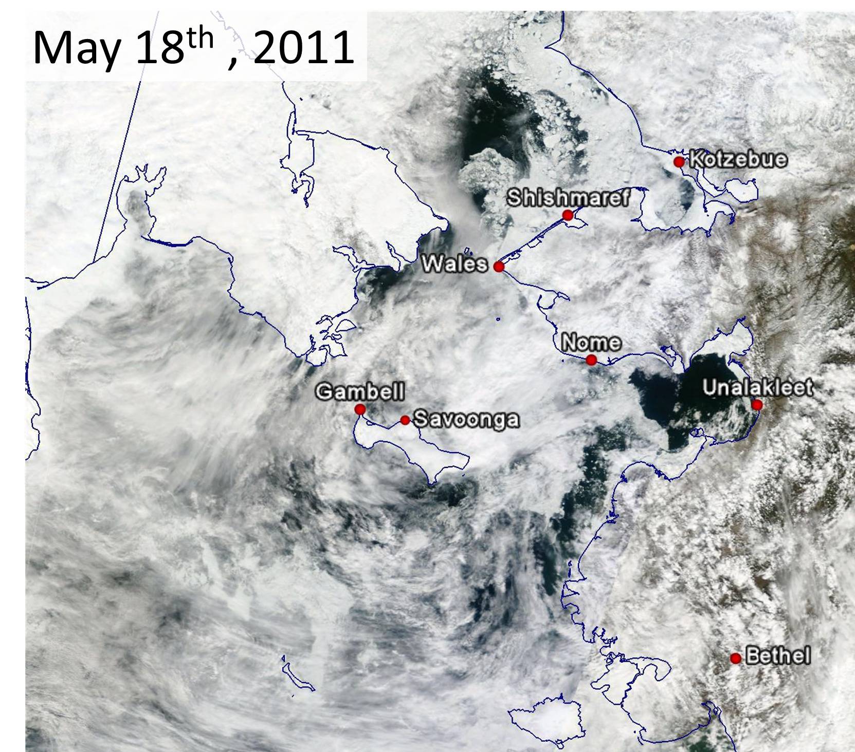
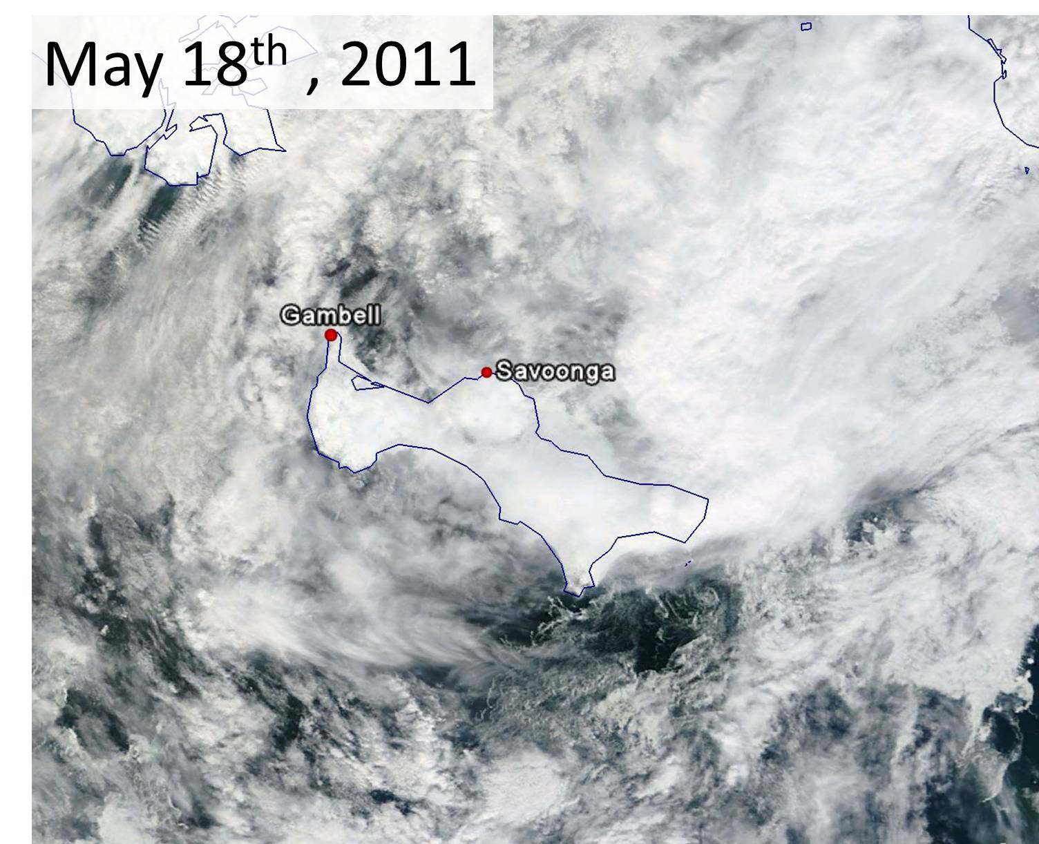
Clouds have made viewing the sea ice coverage and movement a little more challenging this week. There was a larger area of high sea ice concentrations moving westward to the eastern part of St. Lawrence Island this week. In the last couple of days this ice appears to be thinning in concentration and has halted or slowed its westward progression. Another area of sea ice extending from near Savoonga and off to the northeast has been in place and not easily viewed given the clouds. It appears this general area of sea ice has not moved much in the last several days. It may be thinning in coverage as well. Elsewhere around the island, sea ice concentrations have been low.
Wales to Shishmaref
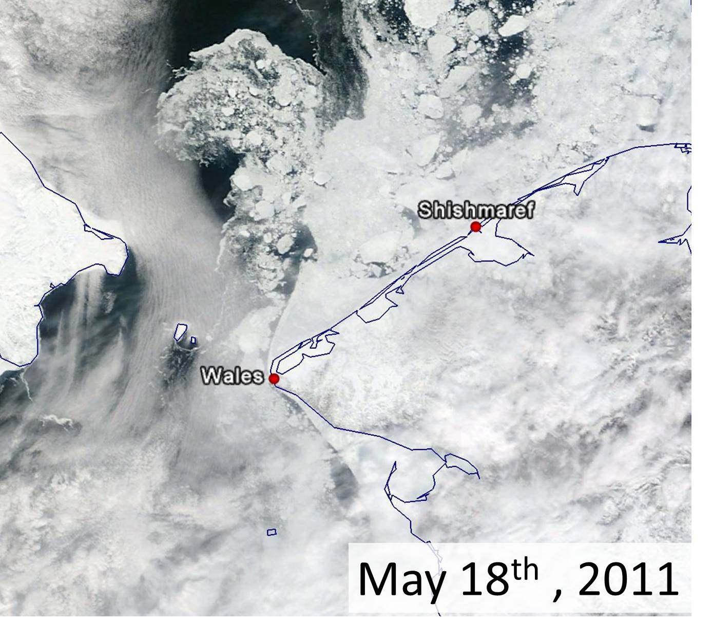
Clouds have persisted around Wales, hindering the view of the sea ice but not as severely as around St. Lawrence Island. The area of sea ice that has been hanging along the west coast is persisting (shifting away and back to the coast depending on the winds). The ice appears to be in high concentrations from the coast of Wales west for about 10 to 15 miles. Beyond 15 miles the water is fairly open with smaller floes. The shorefast ice from Wales to Shishmaref is hanging on in a triangular orientation, somewhat similar to last year. The shorefast ice near Shishmaref to around 30 miles southwest of Shishmaref has largely broken off the coast in the past week. Sea ice concentrations north of the remaining shorefast ice are high, with several large floes 10 to 15 miles in length. The overall movement of the sea ice between Wales and Shishmaref has been to the east.
5-10 Day Forecast
The general storm track will be for low pressure to follow the Aleutian chain into the Gulf of Alaska while higher pressure lingers across the Chukchi Sea. In general, this will keep the northeasterly to easterly flow in place. However, there is not high certainty that the winds will persist from this direction for ten days, due to a few smaller systems. A storm system could move westward across the interior of Alaska and toward the Bering Strait in the middle to latter half of next week. A noticeable warming will likely be associated with this system starting Wednesday or Thursday, 25-26 May. While this would initially strengthen the northerly flow late next week and next weekend, it may reverse the flow by the early part of the following week (around 30 May). Major changes in the sea ice are not expected for the next week or so, however ice concentration will likely continue to decrease around St. Lawrence Island.
Arrows show wind direction and wind speed in knots


Remote Sensing Images


Observations and Comments
Observations of Sea Ice Development
20 May 2011 - Fred O. Tocktoo; Subsistence Ranger, Western Arctic National Parklands
Nome's shore ice lifted this morning and is drifting away. The shore ice broke off at the beach line right in front of town, but left some pushed ice along the shores.
19 May 2011 - Curtis E. Nayokpuk; local observer in Shishmaref
No reports of Bearded Seals (Oogruk) sighted along open leads near Shishmaref. Open leads 3 miles from Shishmaref are too close to shore for "early" Oogruk and hunters will need to travel out 10 to 15 miles when the pack ice opens and spreads out for boat travel. With the sea ice breaking up and leads opening to shorefast ice the hunters will have access to Oogruk moving into shallow water clam beds off Shishmaref and east to Kotzebue Sound.
Travel on shorefast ice to open leads north of Shishmaref has been limited to times of on-shore north winds, due to the thin shorefast ice (6-12 inches) and the steady south/southeast off-shore winds. "Aiak-tuk" is our word for a hunter carried off by ice, who would be lucky to get ashore further up the coast or make landfall along the Kotzebue to Point Hope coast line.
