Assessment of Current Ice Conditions Relevant to Distribution and Access of Walrus
Near St. Lawrence Island
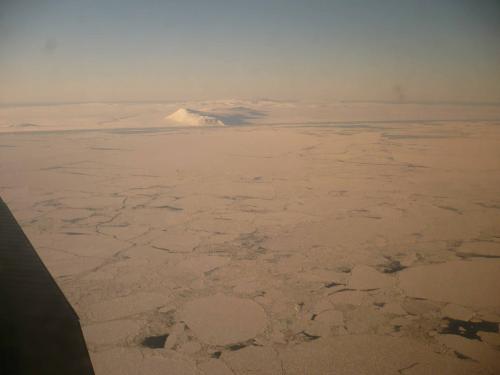
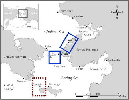
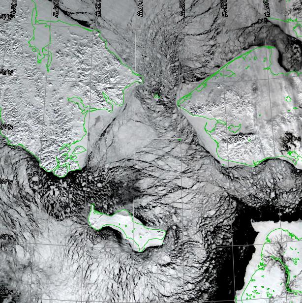
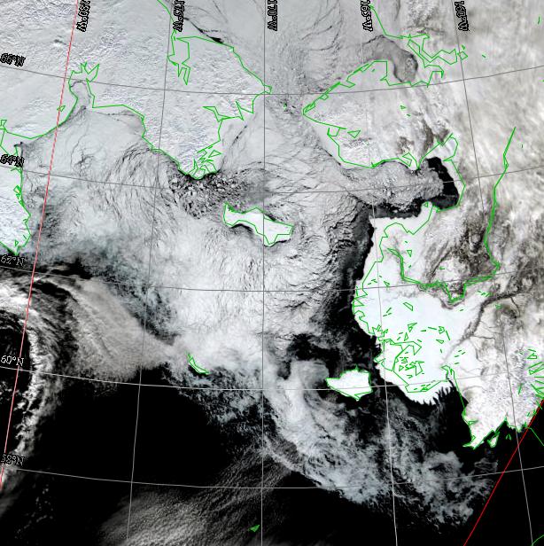
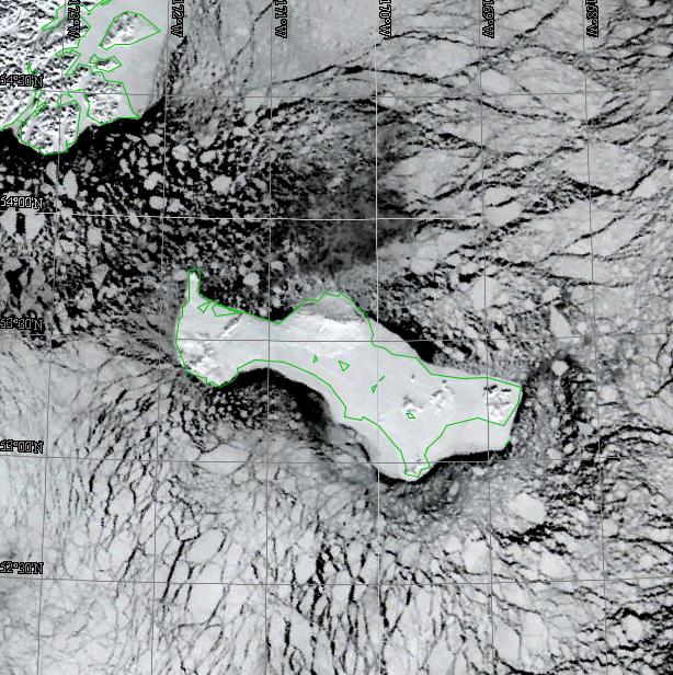
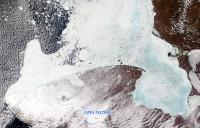
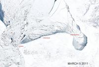
Satellite imagery shows the sea ice around St. Lawrence Island to be made up of numerous broken floes of all sizes. The ice appears thin with many areas of open water leads, and new, young ice just offshore of the expansive shorefast ice, especially along the south side of the island. Conditions are similar along the north coast between Gambell and Savoonga, but the shorefast ice between the two towns is very narrow. Shorefast ice east of Savoonga extends out many miles offshore. Current wind conditions continue to favor the loose pack south of the island.
Wales to Shishmaref
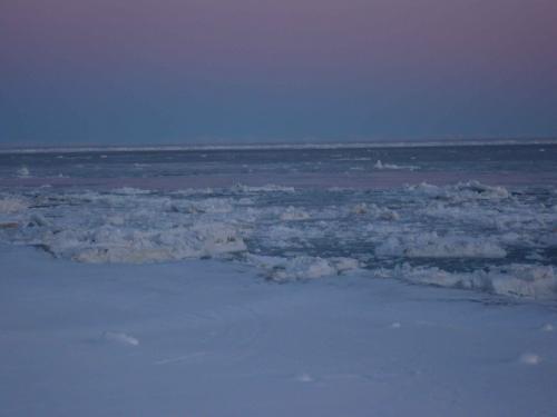
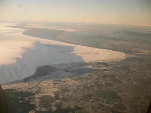
There is extensive shorefast ice just south of Wales and just offshore of Shishmaref. The shorefast ice just off of Wales appears to extend 2-3 miles. A large lead extends south-north in the center of the northern Bering Strait just east of the Diomedes. The pack in the eastern portion of the Bering Strait is loose and made up of numerous broken floes of all sizes. The current conditions appear more like typical late-April conditions than end-of-March conditions.
5 to 10 Day Outlook
For the next five days, the northern Bering Sea and Bering Strait will be dominated by a deep low-pressure system located just south of the Alaska Peninsula, and another deep low that will move eastward from Kamchatka into the central Bering Sea. This will result in strong northerly winds greater than 25 knots, which should push the ice pack southward, closing up the Bering Strait and pushing the ice down on the north coast of St. Lawrence Island. After Wednesday, 6 April the region will be dominated by another strong low-pressure system moving northeast from the western Gulf of Alaska, across the Alaska mainland, and into the eastern Beaufort Sea. This will result in a tight pressure gradient over the region with strong northerly winds of 25-35 knots though 8 April. In the days following 8 April, the winds will drop off to speeds of typically 15 knots, from directions ranging from northwest to northeast.
Arrows show wind direction and wind speed in knots


Remote Sensing Images


Observations and Comments
Observations of Sea Ice Development
31 March 2011 - Hajo Eicken; researcher, University of Alaska Fairbanks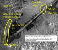
 The radar satellite (left image) appears to indicate that the landfast ice at Gambell was a bit wider on 21 March 2011 than it was last year; this will have to be confirmed by Gambell ice experts, with more information posted later. The north side of St. Lawrence Island is packed in with drift ice at this time, visible in the other satellite images posted above.
In the Bering Strait region, a line of grounded ice pressure ridges appears to have developed as in previous years (see also comments by Curtis Nayokpuk and Fred Tocktoo, below). Comparing the radar satellite (right image) from 21 March 2011 with the images from last year (see 16 April 2010 archive) it appears that this year the grounded ice only extends about half as far out into Bering Strait. While ice may ground later, at the present time this means that the “nose” of ice directing drift ice and marine mammals away from Shishmaref is not as wide as last year. Experts from Shishmaref can provide more details on conditions this year. Also, there is a remarkable amount of level ice in the triangle created by the grounded offshore ridge and the coastline; it shows up as very dark areas in the radar image. If this ice is much thinner than the rougher ice found in past years, it might clear out sooner once break-up starts later this spring. The radar image also appears to show a ridge or rough ice jutting out from the coast to the WSW of Shishmaref, possibly as a result of the ice shove that Winton Weyapuk describes in his observations for the Wales region, below.
31 March 2011 - Hajo Eicken; researcher, University of Alaska Fairbanks

 The radar satellite (left image) appears to indicate that the landfast ice at Gambell was a bit wider on 21 March 2011 than it was last year; this will have to be confirmed by Gambell ice experts, with more information posted later. The north side of St. Lawrence Island is packed in with drift ice at this time, visible in the other satellite images posted above.
In the Bering Strait region, a line of grounded ice pressure ridges appears to have developed as in previous years (see also comments by Curtis Nayokpuk and Fred Tocktoo, below). Comparing the radar satellite (right image) from 21 March 2011 with the images from last year (see 16 April 2010 archive) it appears that this year the grounded ice only extends about half as far out into Bering Strait. While ice may ground later, at the present time this means that the “nose” of ice directing drift ice and marine mammals away from Shishmaref is not as wide as last year. Experts from Shishmaref can provide more details on conditions this year. Also, there is a remarkable amount of level ice in the triangle created by the grounded offshore ridge and the coastline; it shows up as very dark areas in the radar image. If this ice is much thinner than the rougher ice found in past years, it might clear out sooner once break-up starts later this spring. The radar image also appears to show a ridge or rough ice jutting out from the coast to the WSW of Shishmaref, possibly as a result of the ice shove that Winton Weyapuk describes in his observations for the Wales region, below.
31 March 2011 - Winton Weyapuk, Jr.; local observer in Wales
Over the past few days the weather has been clear and mostly calm. Few ponds or leads were visible over the past week, with a large patch of open water 5 miles SW of the village visible on 30 March.
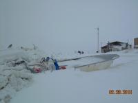
 During the night of 23 February, strong southeasterly winds caused an ice shove (qaupik), with ocean water seeping up along the beach causing overflow in some spots. In some places the shorefast ice was pushed almost all the way up the width of the beach. The very large pressure ridges that were along the outer edge of the shorefast ice were flattened and totally destroyed by the ice surging against them. The edge of the shorefast ice is now very rough making access for boat launch difficult. Pressure ridges had begun forming about one quarter mile further in from the original row of ridges. This is the most extreme ice shove event we have seen to date. The newspaper reported that a number of muskoxen were trapped in our region in flooded areas and died during the same storm surge.
16 March 2011 - Fred O. Tocktoo; Subsistence Ranger, Western Arctic National Parklands
Nome's ice is not good; although there is shorefast ice, most of it lifted up during the first part of March with our heavy southerly winds, and what little shore ice we have is just around downtown Nome, mostly due to Nome's port. Some shore ice just three or four miles east and west of downtown broke off near the shores a week ago. A half-mile out from the shores we have moving ice going back and forth. It doesn’t look good for the spring hunt between Wales and Cape Espenberg.
16 March 2011 - Curtis E. Nayokpuk; local observer in Shishmaref
 The forecast for the weekend is southeast winds up to 30 miles per hour, and temps to 25 above. Very thin ice from Wales to Cape Espenberg, and we will see another 5 mile wide open water lead along the beach again. Wales Shoal "solid ice" is gone this year.
11 March 2011 - Tony Fischbach; Wildlife Biologist, U.S. Geological Survey
